The 10 Best Hikes in the Smokies
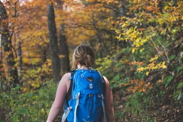
A late hike to Mt. Cammerer in the Great Smoky Mountains. Logan Mahan
By RootsRated– From the smoke-shrouded summit of LeConte and the open-armed expanses of Andrews Bald, down into the laurel laden hollows of Porters Creek and the historic homesteads of Cades Cove, it’s difficult to overstate the majesty of the Smokies. If anything, the grandeur can be overwhelming. With such a depth and breadth of wilderness to take in, it’s hard to know where to start. Have no fear. We introduced you to the general layout of the park with our Guide to the Smokies, and now we’re ready to dig a little deeper with our list of the best hikes in the Smokies. Any difficulty, any length, and in any season, we’ll get you ready to strike out on your own in the nation’s most visited national park.
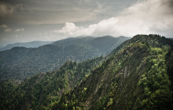
Rocky Top/Thunderhead
Kevin Stewart
http://www.stewart-photography.com/
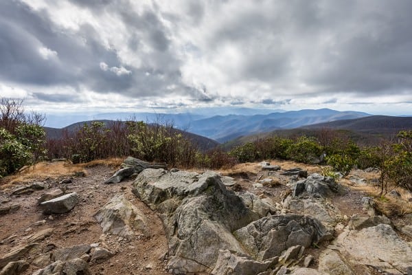
The Applachian Trail crossing the summit of Rocky Top, the westernmost of the three peaks of Thunderhead Mountain. Kevin Stewart
Difficulty: Strenuous
Distance: 13.9 miles roundtrip
Highlights: Appalachian Trail, mountaintop views
A tough hike with more than 3,600 feet of total elevation gain, the climb up to Rocky Top and Thunderhead Mountain is not something hikers should tackle on a whim. For most, the excursion will take all day and require an early morning start to get back before night falls. But if you’re willing to take it on, you’ll be greeted with spectacular views of the North Carolina side of the Smokies and a chance to rub shoulders with thru-hikers.
Andrews Bald
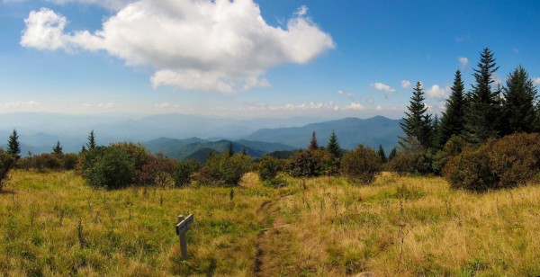
View from Andrews Bald on Forney Ridge Trail. Miguel Vieira
Difficulty: Easy
Distance: 3.6 miles roundtrip
Highlights: Grassy bald, short hike, mountaintop views
Only 1.8 miles from the Clingman’s Dome parking lot is a grassy expanse of open air ambience known as Andrews Bald. During all but the coldest months, the road up to Clingman’s Dome allows easy access to this perfect picnic spot for families, friends, or anyone that might have a “The Hills are Alive” itch they need to scratch. In the winter, though, when Clingman’s Dome road is closed, access to Andrews demands a lot more resolve and a tough 10 mile hike (one-way!) southbound on the Appalachian Trail.
Porters Creek
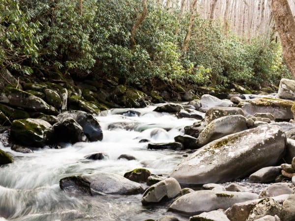
The lively waters of Porters Creek follow hikers all the way down the trail. Cody Myers
Difficulty: Moderate
Distance: 4 miles roundtrip
Highlights: Historic landmarks, spring wildflowers
Porters Creek Trail is great any time of year, but its low elevation and gentle slopes make it especially wonderful in the spring, when some of the higher elevation trails are still unpredictable due to snow and ice. This gentle, peaceful trail mixes beautiful wildflowers and lively waters with some notable historic sites. Hikers can follow the banks of babbling Porters Creek for a few miles among carpets of trillium, eventually coming upon the old stone walls of the Elbert Cantrell farmstead and the tombstones of Ownby Cemetery, both from the early 20th Century. Other historic landmarks along the trail include the John Messner farm site and a cabin built by the Smoky Mountain Hiking Club in the mid-1930s.
Mount Leconte Via Alum Caves
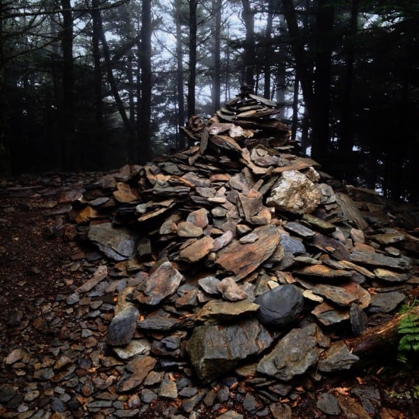
The giant cairn at High Top marks the true summit of Mount Leconte. Logan Mahan
Difficulty: Strenuous
Distance: About 11 miles roundtrip
Highlights: Lodge with hot chocolate, Alum Cave, mountaintop views
Mount LeConte is one of the most popular mountains in the park, with six ways to get to the summit: the Boulevard, Rainbow Falls, Trillium Gap, Bull Head, Brushy Mountain, and the shortest, steepest, and most popular access, Alum Cave Trail. Along the way, you’ll encounter a number of notable landmarks including Arch Rock, Inspiration Point, and 80-foot high Alum Cave Bluff. Your steep ascent will enmesh you into a swarm of Fraser firs near 6,000 feet before leveling out near the summit. You’ll suddenly emerge onto a series of cabins that make up LeConte Lodge, built in the 1920s and only accessible by trail. Hikers wanting to spend a night here typically have to reserve their spot well in advance, but anyone who makes it this far is welcome to stop in and warm themselves by the stove.
A little bit past the lodge is the true summit of LeConte, marked by a large cairn made mostly of sheet-like shale a little ways off the main trail. A short way past this is Myrtle Point, a panoramic spot with the best sunrises the mountain has to offer. A little closer to the lodge is Cliff Top, which has the best sunset views.
Rich Mountain Loop
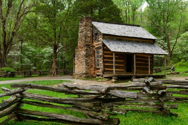
Cades Cove, Great Smoky Mountains National Park
See historic sites like the John Olver Cabin without enduring the standstill traffic of Cades Cove Loop. Charlie Choc
Difficulty: Strenuous
Distance: 8.5 miles roundtrip
Highlights: Diverse wildflower displays, historic sights, no gridlock!
Vast carpets of spring wildflowers, historic Appalachian homes, and pleasant valley views all come standard with the Cades Cove experience. But that experience is also often paired with a painfully slow crawl of sedans and minivans packed tightly along the main loop. If you want to do Cades Cove without the bumper-to-bumper, get out and stretch your legs on Rich Mountain Loop. Here you can get an up-close-and-personal view of the history and beauty of the Cove and see some of the most diverse wildflower displays in the park.
Ramsey Cascades
Near the bottom of the 90-foot Ramsey Cascades is a large stone ledge, which is great for a picnic lunch. Jon Yoder
Difficulty: Moderate-strenuous
Distance: 8 miles round-trip
Highlights: Waterfall, old-growth forest
Before you even reach the trailhead, you’re liable to notice how special this tucked away part of the park is. You’ll drive through towering trees as you follow the Middle Prong of the Little Pigeon River. From the trailhead parking lot, set out on foot down an old road bed until the trail curves away onto a more rugged (but still discernible) trail where you’ll be greeted by large tulip trees, hemlocks, and big black cherries—some of the largest trees in the park. You’ll soon encounter Ramsey Prong, which will be your babbling, gurgling, surging companion for almost the entirety of the remaining hike. After a pretty steep final climb, the trail ends at stunning, 90-foot tall Ramsey Cascades. There’s a large stone ledge near the falls that’s great for a picnic lunch.
Chimney Tops
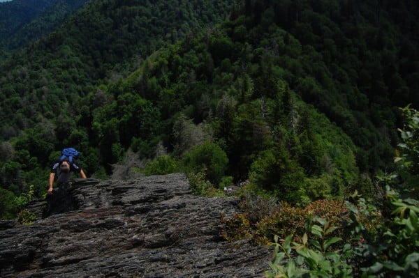
The last push to the summit of Chimney Tops is not for the faint of heart. Trevin Shirey
Difficulty: Strenuous
Distance: 4 miles roundtrip
Highlights: Steep, rugged peak, short (but steep!) climb
From Steven Reinhold‘s riveting review of Chimney Tops:
“The twin-peaked, rugged profile of The Chimney Tops gained infamy with its appearance on the cover of Horace Kephart’s classic, Our Southern Highlanders. The summit of this 4,724-foot peak has weathered away over the centuries leaving behind a backbone of folded metamorphic rock, which has turned into a playground for the adventurous. The trail to the Chimneys was badly damaged several years ago by torrential downpours and flooding. Thanks to the Great Smokies’ Trails Forever Program, a newly renovated trail takes hikers from the Trailhead to the airy summit by way of a steep, intricately constructed, 2 mile trail.”
Charlies Bunion and The Jump Off
The sweeping, Smoky views from Charlies Bunion. Justin Meissen
Difficulty: Moderate
Distance: 9.5 miles roundtrip
Highlights: Mountaintop views, exposed outcroppings, Appalachian Trail
Charlies Bunion and the Jump Off are typically at the top of the list for any Smoky Mountain explorer. And for good reason. These two ridge-line overlooks offer a worthwhile trip when sought out separately, but when tackled together, they create one of the most quintessential Smoky Mountain experiences you can have. Delight in the thinning crowds as you set out from the overpopulated Newfound Gap into the high mountain wilderness along perhaps the best section of the Appalachian Trail found in the park. The cover of trees opens frequently to reveal majestic views of the surrounding mountainscape as you climb a steep and spiny path for the first few miles. At 2.7 miles in, you’ll take the left junction toward the Boulevard Trail, which would take you all the way to Mount LeConte, if you felt so inclined. But for this excursion, you’ll only hike briefly here before turning onto the the junction for the Jump Off. Another half mile and you’ll reach your destination: a 1,000-foot, vegetation-covered cliff face on the side of Mt. Kephart. The Jump Off gives you dazzling views of Mount Guyot as well as of your next destination, Charlies Bunion.
Double back to the Appalachian Trail and continue on for a little more than a mile until you see the spur trail for Charlies Bunion. As you curve along the high rock walls to the overlook, prepare yourself for some pretty killer views of Mt. LeConte and Mt. Chapman. This large exposed rock face is rare in the Smokies and is a product of fire and flood that destroyed the trees and soil that covered the area a hundred years ago. Now, it’s one of the best day hikes in the park.
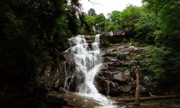
Spruce Flat Falls
Spruce Flats Falls – Great Smoky Mountains National Park
Even on busy park weekends, Spruce Flat Falls has much less traffic than most comparable waterfall trails in the Smokies. Kevin Stewart
Difficulty: Easy-moderate
Distance: 2 miles roundtrip
Highlights: Short hike, less-frequented, 30-foot cascades
Across from the Tremont Visitors Center is a little unassuming road leading back into the Tremont complex. Shortly, the paved road ends and one can follow a nearby trail left uphill into the mountains. This is the true start of one of the Smoky Mountains’ hidden gems. Hikers need simply to follow the signs marked “falls” for an easy-to-moderate mile. The descent into the valley at the end of the hike might be the hardest part, with some rocks and thick protruding roots making the trail a bit treacherous for less seasoned hikers. After this, hikers will be rewarded with one of the best waterfalls visible in the Smokies without needing to pack a lunch. Relatively unknown, Spruce Flat Falls is a favorite among locals who want a quieter experience in the Smokies but may not have the time to tackle one of the longer waterfall trails. The main cascade plummets 30 feet and continues down several smaller drops before connecting to the Middle Prong. Hikers will forget how close they are to the bustle of the main Smokies thoroughfares, unless they decide to rock-hop downstream a bit, where Upper Tremont Road can be seen through the trees below.
Mount Cammerer
Beautiful fall colors decorate the AT on Mount Cammerer. Logan Mahan
Difficulty: Strenuous
Distance: About 11 miles roundtrip
Highlights: 360-degree views, Appalachian Trail
Mount Cammerer guarantees one of the best Smoky Mountain views for those dexterous hikers who manage to reach the summit. From the lookout tower at the top of the mountain, one can see the rolling mountains and foothills of the Southern Appalachians in a 360-degree panorama. That’s not to say, of course, that this hike is only about the destination. Both popular access points from Cosby Campground and Big Creek offer history, beauty, and a chance to meet Appalachian Trail thru-hikers along the way.
Originally written by RootsRated for RootsRated